Using KML Files
Bring your own data onto the map, like noise, heritage, or environmental impacts.
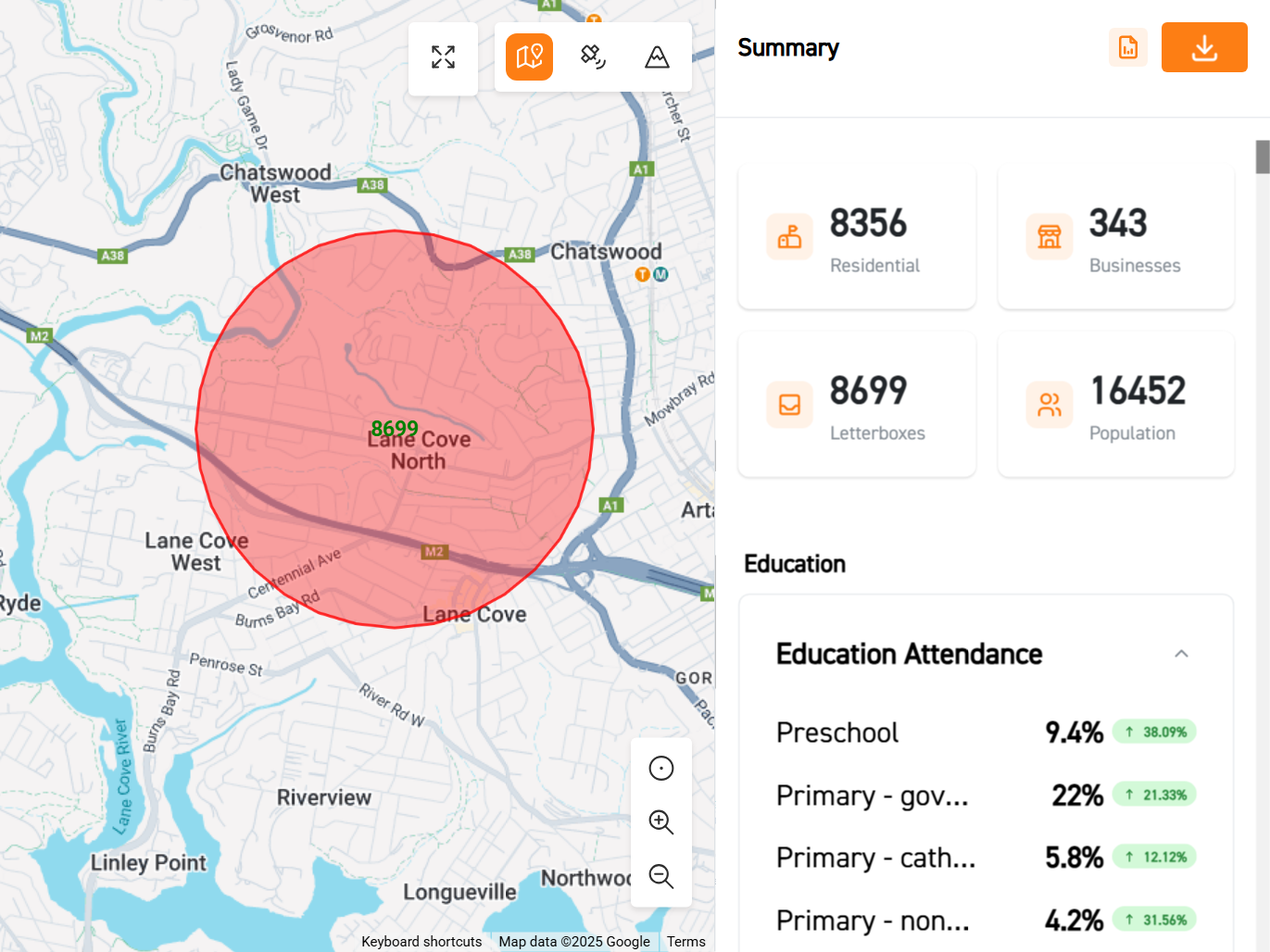
See impacts on a map
Import KML* files to visualise impacts, such as which properties will be impacted by construction noise or that fall inside a heritage boundary.
*KML is a standard file format for geographic data, commonly used in tools like Google Earth.
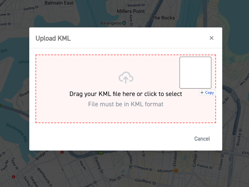
How to upload KML files
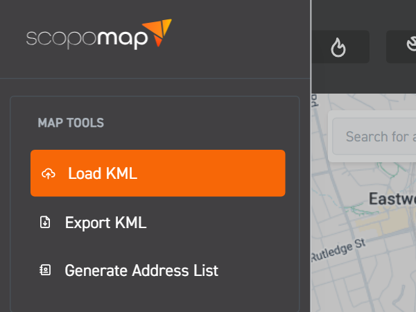
1. Select "Load KML"
Click on "Load KML" from the side menu.
2. Drag KML file
Drag and drop the .kml file into the upload box.
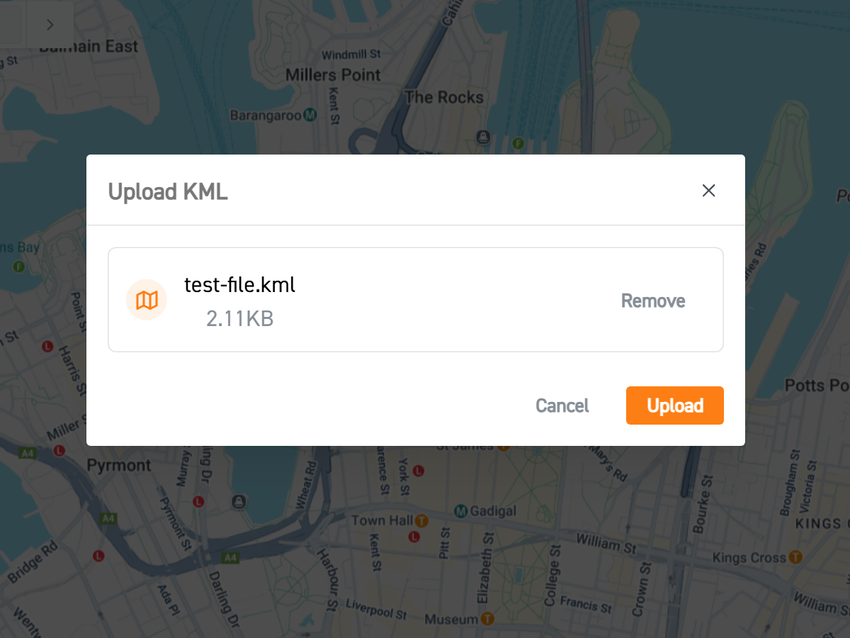
3. Select “Upload”
Press the orange “Upload” button to upload the map.
Map Your World, Your Way.
Ready to put all your data on the map?
Don't just look at demographics – bring all your important geographic data to life! Easily import KML files to visualise things like noise impacts, heritage spots, or any other custom insights, right alongside your community demographics. Get the whole picture and make smarter calls.