Map Sets
Ready-made maps of any LGA, electorate, suburb, or postcode
Data that's already mapped
Get instant LGA, electorate, and suburb-wide insights without having to build a map yourself. Perfect for projects with local councils and government agencies.
How to use Map Sets
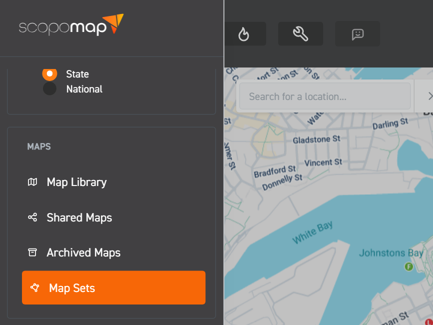
1. Select "Map Sets"
Click on "Map Sets" from the side menu.
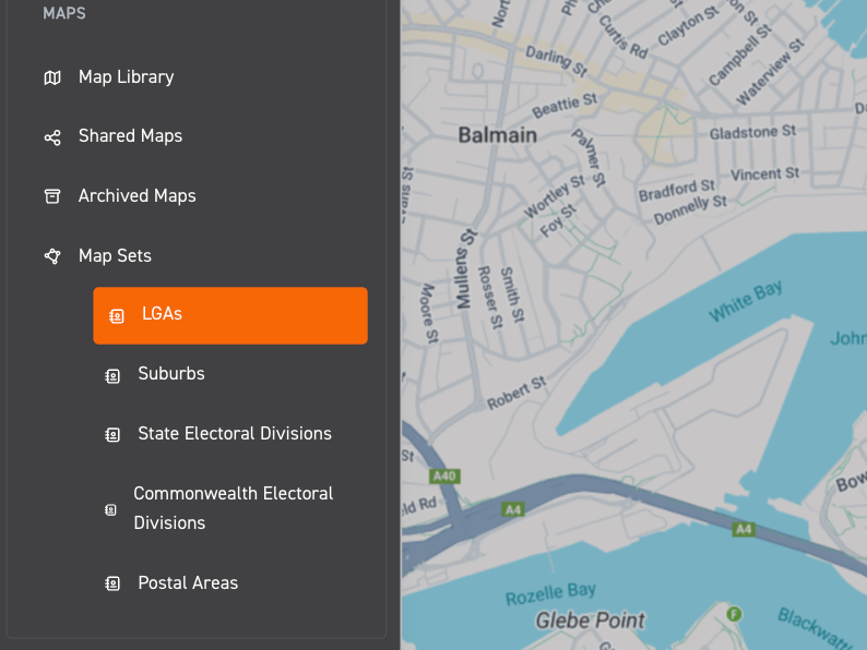
2. Select a map set category
Select one of the following map set categories: LGAs, Suburbs, State Electoral Divisions, Commonwealth Electoral Divisions, or Postal Areas (postcodes).
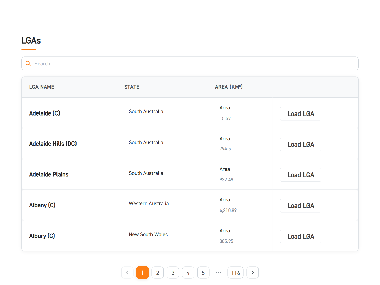
3. Select your map set
Type in the name of the LGA, electorate, suburb or postcode in the search bar or scroll through the list alphabetically/numerically. Then click on the map you want to explore.
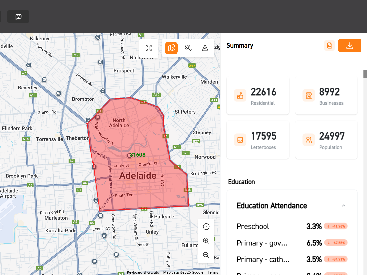
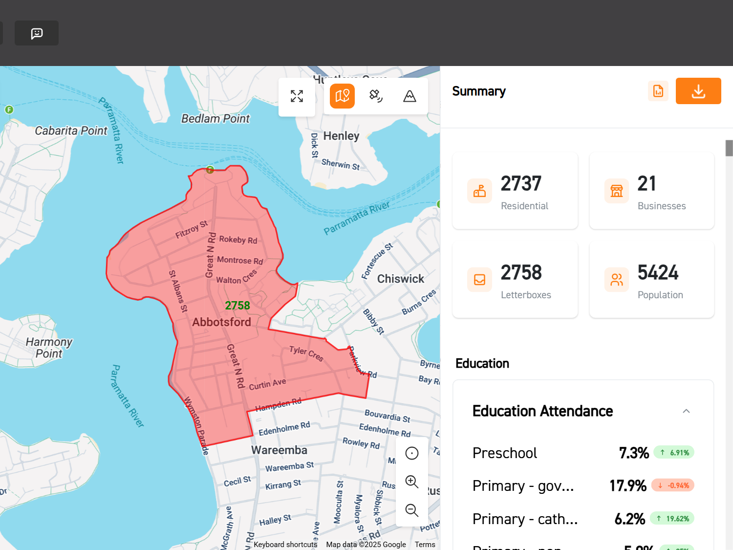
4. Get insights
Start with an instant snapshot of your suburb, LGA, electorate or postcode. Then dig deeper: chat with Bruce, use heatmaps and filters, or extract addresses.
Instant Community Maps
Ready to map out any Australian community, instantly?
Forget drawing boundaries from scratch. Our Map Sets give you instant access to ready-made maps for every Aussie suburb, electorate, or LGA. You'll get an immediate demographic snapshot, ready for analysis – no mucking around, just straight to the insights.